Status of Regulated Drains in Vermillion County – October 2025
Brief History
In 1965, the Legislature worked to combine multiple and sometime conflicting statues into a single document entitled “Drainage Law” I.C. 36-9-27. In this statute it describes how county drainage boards were supposed be set up, who was responsible for constructing, inspecting, and maintaining county drains now bearing the title of Regulated Drains, and how such work was to be funded by the watershed participants for each Regulated Drain, separate from one another.
In 1966, Vermillion County Commissioners, assuming the authority of the Vermillion County Drainage Board, authorized an audit of the Commissioner Record Books by Mary B. Swayze to determine what “Legal” Regulated Drains already constructed were county responsibility.
Ms. Swayze delivered a detailed report to the Commissioners upon the completion of her audit identifying the following Drains:
Armour Morgan, et al, Public Drain (Highland Township)
Morgan, Puffer Manford, Stewart, et al, Public Ditch (Helt Township)
Henry C. Carithers Public Ditch (Highland Township)
Henry Volkill, et al, Public ditch (Highland Township)
Thomas C Hood, et al, Public Drain (Town of Dana)
E.B. Bell, et al, Public Drain (Helt Township)
John L Brown Public Drain (Helt Township)
This report was supposed to be kept on file in the County Surveyor’s Office. As of this writing, that file has never been found. The Commissioners failed to establish the corresponding watershed participants of each drain into the organized group for each individual drain to share in the expense for the maintenance and upkeep of these structures, according to the statute.
Further, we have discovered records for the McNeil Drain which runs from Illinois at US Hwy 136 south, crossing under I-74, and draining into Spring Creek.
In 2012, IC 36-2-12 was enacted giving the County Surveyor the total responsibility for the construction, maintenance and upkeep of all county Regulated Drain structures.
1. THOMAS C. HOOD PUBLIC DRAIN – Status Recorded – ACTIVE
The original petition for the Thomas C. Hood Public Drain was filed in the circuit court in 1942. Around 1968, the Vermillion County Soil & Water Conservation District, along with USDA help and funding, helped watershed participants file petitions with the circuit court for the establishment of the Ernie Pyle Regulated Drain. This work expanded the Thomas C. Hood Public Drain to include large areas around the Town of Dana, incorporated town storm sewer systems, all of which eventually drain to a creek south of County Road 700 S. When construction was complete, the SWCD correctly set up the watershed participant list for maintenance assessments and then released the responsibility for inspection and maintenance to the Vermillion County Drainage Board – i.e. Commissioners.
The Commissioners decided that instead of using the assessed funds from the watershed participants to hire contractors to maintain the structure, they would assign county road crews to do the work. After some time, the watershed participants became “disenchanted / dissatisfied” with the amount and type of work being done to maintain the structure. After confronting the Commissioners, the Commissioners decided to “just turn it over to the farmers to take care of.”
But the Commissioners failed to legally abandon the structure while the county continued to collect assessments for maintenance. So then, when “the farmers” as private citizens worked on the structure, or hired work done, they just submitted a bill to the county for payment. The problem was that private citizens cannot spend taxed dollars. So, in 2021, the Dana District Drainage Board, including by-laws as required by law, was formed and recognized by the Vermillion County Drainage Board. This then legally allows for either board, depending on the amount of maintenance funds spent, to approve maintenance work for the structure outside the town limits of Dana, and payment for same.
Annually, inspections of the entire structure take place. Weed and brush control have begun by licensed contractors, eradication of rodent pests is taking place by licensed contractors. The structure was evaluated in 2024 & 2025 to determine if there are areas that need dredged or similar excavations done, including bank and culvert repair. Also, most of the areas on the ditch bank with heavy brush have been cleared, and the swampy area located at the front of the AC Grain Terminal has been cleared of vegetation and treated with herbicide. Our next steps will be focused on stabilizing the swampy area (cover with rip rap?) and then dredge areas of the ditch that has filled with silt over the years that is slowing down the flow of water.
2. ARMOUR MORGAN, et al, PUBLIC DRAIN – Status Recorded – ACTIVE
The original petition for this drain was filed in the circuit court in 1944 which was designed to drain around 1000 acres (considered a big area in 1944). Since that time, multiple grass waterways and field tile systems have been added expanding the watershed, the county replaced a small culvert in C.R. 1300 N (which acted as a dam slowing water flow) with a large box culvert thus increasing the water shed several hundred acres, and Hwy. 63 was redesigned going from a 2-lane road to a 4-lane road which caused large areas on the east side of the road to drain west. The watershed now appears to include the majority of acres from Hwy. 32 north to C.R. 1450 (est. 1000 acres +/-). In the 1980’s the USDA Soil Conservation Service evaluated the drain at the request of landowners to find that the existing main tile was grossly undersized, far too shallow, and far too flat to carry the amount of water now draining through the system.
The Vermillion County Drainage Board voted to contact the landowners to determine if they had interest in the county re-establishing this structure as a Regulated Drain while incorporating all the additional watershed area that had developed over the years. To clearly evaluate the complex nature of this structure, the board hired DES Engineering to evaluate the drain, properly determine watershed
Acreage and ownership, and then develop a plan in whole, or in stages, to bring the entire structure up to functioning properly for years to come, along with associated costs.
The landowners voted to reestablish the structure as a Regulated Drain, the Board completed the legal process of legally re-establishing the Armour Morgan Public / Regulated Drain with maintenance assessments starting in 2025.
3. MC NEIL DRAIN – Status – DETERMINED TO BE A PRIVATELY FUNDED, MUTUAL DRAIN
This structure was moved up in priority for evaluation of reestablishment for a Regulated Drain due to the number of calls the Surveyor’s Office has received from landowners in the area where it is rumored development might be on the horizon. Their concern is ensuring this drain is preserved. From initial appearances, this structure seems to be working – some weed and brush control is needed in a few parts. After a very lengthy investigation (2 years) of this structure’s origin, we learned that is was built as a Privately Funded Mutual Drain and therefore not under the Drainage Board jurisdiction. If landowners ever felt that they should need to put it under county control, they would be required to submit petitions to the Drainage Board requesting such and the legal process to establish it as a Regulated / Public Drain would begin.
4. D. ROUSE PUBLIC / REGULATED DRAIN – Status – IN PROCESS OF BEING RE-ESTABLISHED
The Commissioner Records show that this is the structure that runs east and west through Rileysburg on the North side of the Railroad tracks, first petitioned in 1898. Later, when the bridge south of Rileysburg was being replaced with a culvert in 2018, the County Surveyor declared that the ditch extending to the Illinois State Line on the south side of the railroad tracks was part of the Regulated / Public Drain. From initial appearances, this structure seems to be working – weed and brush control is needed in most parts. With the designation of the I-74 TIFF District Phase I being the Rileysburg area, the long history of flooding in Rileysburg, and more development planned in Illinois, Landowners were contacted gathering input as to whether the structure needed to be vacated or re-established as a county structure. The majority of the landowners have indicated the drain needed to legally re-established so as to provide a means of redesign and reconstruction. The Drainage Board is currently in process of following statutes to re-establish the D. Rouse Drain and a Public /Regulated Drain.
5. HENRY VOLKILL DITCH – Status Recorded – VACATED
This is a large mostly open waterway ditch that runs south west from north of Hwy.32 crossing to cross under Co. Rd. 100 West draining into Jordan Branch. Most of this structure crosses 1 farm and has been well maintained. The Drainage Board received a request from the landowner to vacate this drain. After all the statute required notices were made to participating landowners in the watershed, no objections were received, so the Drainage Board voted to Vacate this structure.
6. RAMSEY DRAIN – Status Recorded – VACATED
This was a ditch than ran North to South between Perrysville and the Wabash River, emptying into the river on the north side of the Hwy. 32 Bridge. It was first established in 1939. Over the years it had become overgrown and parts even developed into a swamp / marsh. Much of the land in the watershed has been enrolled in CRP and no longer farmed. The Drainage Board voted to Vacate this structure.
OTHER DITCHES / DRAINS
The following ditches / tile drains were listed as being a “Public Drain” in the Commissioner’s Record Books, but no other legal descriptions, court documents, or other references were found to support the legal status of these structures. Public Notices were published announcing the Drainage Board’s intent to Vacate these drains. Receiving no objections regarding the vacation, the Drainage Board voted to individually Vacate the following drains:
7. E.B. Bell Public Drain – Status Recorded – VACATED
8. Elder Hulbert Public Drain – Status Recorded – VACATED
9. Dana Drainage Line “B” Drain – Status Recorded – VACATED
10. John L. Brown Public Drain – Status Recorded – VACATED
11. THE CARITHERS PUBLIC DRAIN –Status – YET TO BE DETERMINED
This is a large tile than runs north to south from Co. Rd. 1550 N emptying into a ditch in an area that would be considered as 1400 North (if such road existed), and lays between Hwy. 63 and Co. Rd. 100 West. This tile crosses mainly 1 landowner but may be affected if /when development occurs in the I-74 TIFF District. The Drainage Board will address its legal status sometime in the future.
12. MORGAN PUFFER, MANFORD STEWART PUBLIC DITCH – Status – IN PROCESS TO BE VACATED
This is mostly a large tile that runs south and east from the sharp turn in Hwy. 71 just north and west of the old Ernie Pyle School. Much of this area has been leased for future Solar Farm development. Area Ag producers have voiced concerns that the drainage system might be affected with Solar Farm construction. Subsequent meeting with the Solar Farm developers have addressed the concerns of Ag Producers. The Drainage board is in process of vacating the structure.
13. THOMPSON DRAIN – Status – YET TO BE DETERMINED
This is a large ditch that lays west of the Thomas Hood / Ernie Pyle Drain watershed, north of Co. Rd. 500 S., running along the old railroad bed in places, and terminates at the Illinois State Line. The Drainage Board will address its legal status sometime in the future.
FUTURE WORK
Due to the multiple complaints in the following areas, the VCDB will have to begin studying how these areas can be helped with flooding of homes, roads and fields. Since these areas are relatively close, it may be possible to develop a master plan covering all, and then work on phases to completion, over a number of years.
St. Bernice – west of old rail road bed
St. Bernice – Jonestown road running east
Blanford – west of old rail road bed
Centenary – south of Hwy 163
Centenary – north of Hwy 163
Sandytown – running along the old rail road bed just west of Hwy 63
Respectfully Submitted,
Ronald A. Mack
Vermillion County Surveyor
NOTE: MINUTES OF VERMILLION COUNTY DRAINAGE BOARDMINUTES ARE RECORDED IN THE NOTE SECTION OF THE MEETING SCHEDULE FOUND ON THE VERMILLION COUNTY GOVERNMENT CALENDAR.
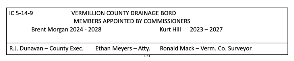
Drainage Board Members
Kurt Hill 2023-2027
Brent Morgan 2024-2028
Dan Bridge 2024-2026
Tyler Smith 2025-2029
Indiana Drainage Law
VC Drainage Board Rules of Procedure
VC Active Regulated / Public Drains
Vacated Regulated / Public Drains
Suspected Underground Utility Locations
MUST CALL 811 FOR LOCATIONS BEFORE DIGGING
Comcast Cable
ILLINOIS BORDER TO CAYUGA – IN ST. RD. 234 (CR 410 N, CR 480 N, CR 150 W)
CAYUGA TO WABASH RIVER – IN 234 (E. CR 480 N)
SOUTH CAYUGA 8TH STREET TO MEDICAL OFFICE – (W. CR 400 N)