Vermillion County Surveyor

Ronald A. Mack
Vermilion County Surveyor
Vermillion County Courthouse – Rm. 206
P.O. Box 280225 Main Street
Newport, IN 47966
Ph: 765-492-5366
Email: ronald.mack@vermillioncounty.in.gov
Scheduled Office Hours: Tues., Wed., & Thurs. – 9:00 A.M. to 4:00 P.M.
By Appointment: Mon., Fri., Sat.
List of Registered Professional Licensed Surveyors
Indiana Statutes for Land Survey
VC Section Cornerstone Monument TIE Cards-Verified
VC Section Corner Stone Monument TIE Cards – Non-Verified
U.S. Bureau of Land Management Archives
VC Drainage Board Rules of Procedure
Suspected Underground Utility Locations:
MUST CALL 811 for locations BEFORE you dig.
GIS Map: https://vermillionin.wthgis.com/
Search for Recorded Surveys and Documents here (Post 1969 only): Doxpop
Functions of the County Surveyor
The Indiana Constitution officially established the County Surveyor as an elected office. The obligations of an elected County Surveyor are addressed in Indiana Code: Title 36, Article 2, Chapter 12, Sections 1 to 15.
Various Indiana Codes and Indiana Administrative Codes govern how a County Surveyor performs these obligations. The County Surveyor is also guided by Federal requirements (such as the Clean Water Act and the Endangered Species Act) which are administered by agencies such as the US EPA, US Army Corps of Engineers and the US Fish and Wildlife Service.
1. Stormwater Management – Water Quantity
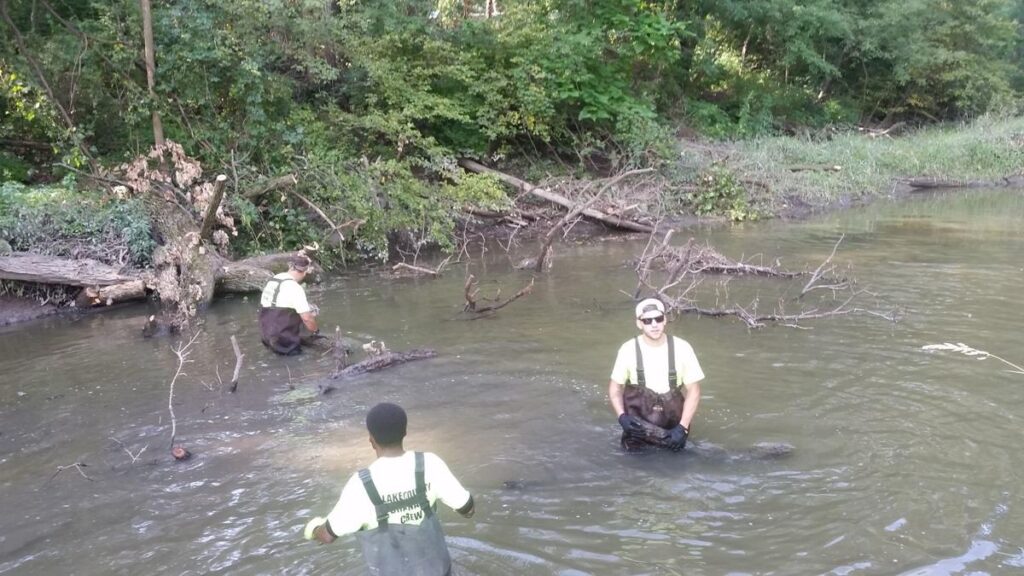
The County Surveyor is a county’s technical authority on drainage. Every county has a Drainage Board, and every County Surveyor is an ex-officio member of the Board. This means the Surveyor manages the construction, reconstruction, vacation/removal and maintenance of all regulated drains and proposed regulated drains.
The Surveyor is responsible for the field investigations of drains, and develops drainage studies and technical specifications for work performed on tile drains and open ditches. They are responsible for reconstruction petitions, new drain construction, and Public Hearings concerning maintenance funds. They often supervise the investments of the assessments collected to support or maintain the Regulated Drain Infrastructure. Your County Surveyor works hard to try and protect citizens from flooding and drainage problems.
For most counties, the County Surveyor is either responsible for, or is involved in, seeing that we keep our waters clean. One way they achieve that goal is by interpreting and implementing Stormwater requirements mandated by the Environmental Protection Agency under the federal Clean Water Act’s National Pollutant Discharge Elimination System (NPDES) permitting program.
Additionally, the County Surveyor often sets minimum standards for filter strips which prevent valuable topsoil from running off into our rivers and streams. They are also responsible for ensuring proper construction on regulated drains including grading, drainage structures, and erosion control practices.
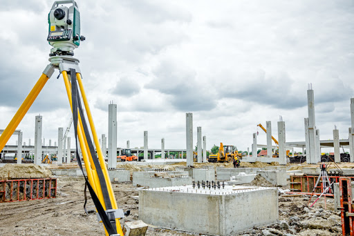
2. Site Development
When development occurs in your county or community, the County Surveyor often works hand in hand with other community officials to ensure the existing residents are not negatively impacted. Their efforts help protect the neighbors upstream and downstream from pollution and flooding while the work is underway and after it is completed.
A review of the information contained within the County Surveyor’s Office (maps, surveys, topos, aerials or even the technical requirements for the submission of the plat) can be very instrumental in a smooth transition from planning through construction to completion.
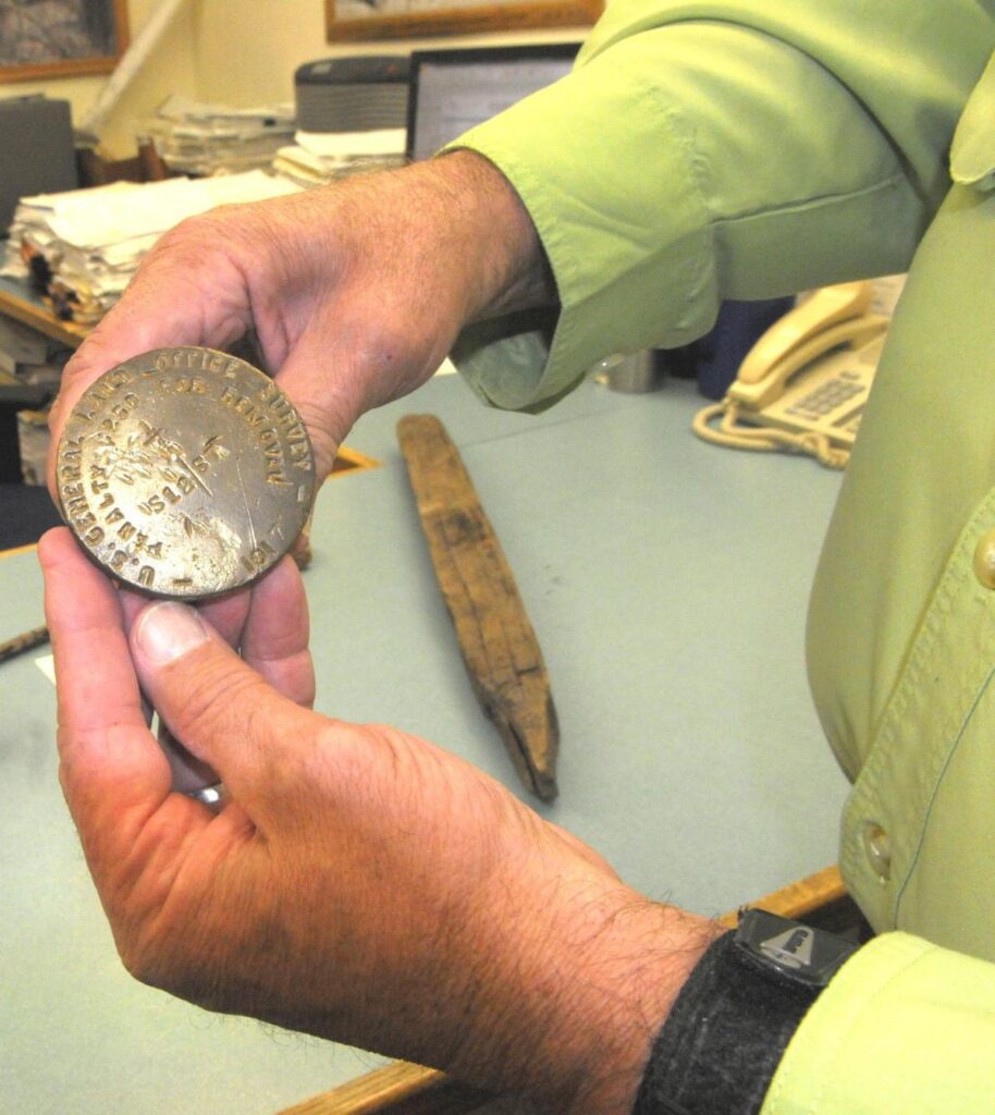
3. Section Corner Perpetuation
Every deed, parcel, and legal land document in the State of Indiana is tied into the original survey performed in the early years of settlement. Section corner stones were set to mark each square mile of the State. In order to prevent gaps and overlaps of land ownership it is of the upmost importance that these markers are maintained.
The County Surveyor is tasked with the job of finding section corner stones, (by digging in roadways, yards and fields) referencing them by measurements to nearby structures, (such as utility poles, fence posts and buildings) and marking the location of the section corner at the surface (of the ground, roadways, etc.).
The County Surveyor must maintain a corner record book showing original government section corners, and is required to establish, locate, and reference at least 5% of the corners each year.
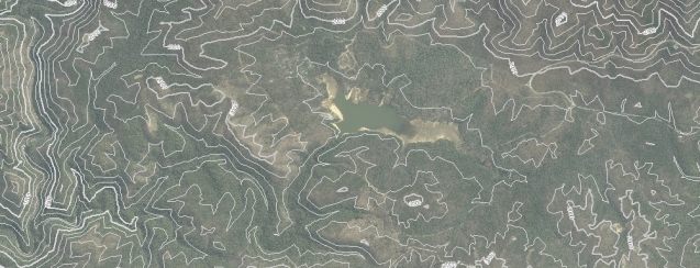
4. Geographic Information Systems (GIS)
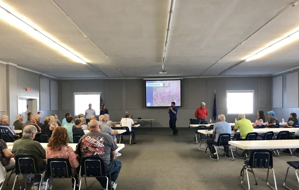
Counties have led the way in the State of Indiana to produce geographic information systems and County Surveyors are at the forefront of the GIS process in their counties. GIS is a computer based smart map that can be queried.
GIS may be used for many things by the citizens of a county. These maps include property lines, streets, aerial photography, county regulated drains and their watersheds. They sometimes include voter precinct maps, flood zone maps, or school district maps. These maps may provide computer generated school bus routes to reduce time, save money, and increase safety.
5. Did You Know?
Your County Surveyor is a member and technical advisor to your County Plan Commission. They also advise various technical committees reviewing subdivisions, drainage plans, and development plans. They may also be a member of one of the various River Basin Commissions or Regional Planning Authorities established by the State. In each instance, the surveyor is there to serve as the citizens’ advocate protecting their property and well-being.
The Indiana Alcoholic Beverage Commission requires a state form to be signed by the Surveyor to verify the Business Location for ABC permits.
The Surveyor’s office maintains information such as bench marks, USGS Topo Maps, Wetland Inventory Maps, Flood Zone Maps, Surveyors Records, aerials, and drain files.
The County Surveyor keeps annexation and dis-annexation descriptions for each city and town on file.
The Surveyor maintains a Legal Survey Record Book for all “legal surveys” within the county. These surveys, prepared by a licensed surveyor resolve property disputes.
Summing it Up
The duties of your County Surveyor are many, but a large focus of what they do is meant to reduce flooding, while maintaining clean water in our lakes, ponds, regulated drains, rivers, streams and wetlands.
Your County Surveyor is there to help properly manage and coordinate the growth of our Indiana communities, while at all times being a good steward of our natural resources and tax dollars.